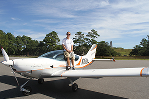
A few years ago I began my training to obtain a private pilot’s license. Lucky for me, there was a great local instructor available on Currituck Mainland, so most of my training was around or close to the Outer Banks. As a local who walked, cycled and drove around this area all of my life, I thought I had the geography figured out, but my flight experience would soon change these views.

My initial flight was more or less a scenic tour to get me comfortable in the small training aircraft. I was a bit nervous at take-off, but once I got my first aerial view of the Outer Banks, my nervousness subsided and my excitement level grew. From 2,000 feet above the ground, the Outer Banks looks like an oversized sandbar, and I realized the geography was much different than anticipated.
Starting in Corolla, we flew southbound along the beach, 1000 feet and below. We passed the Currituck Lighthouse and the Whalehead Club and toured above Monkey Island on the Currituck Sound. Traveling at 100 knots, Ocean Sands and Pine Island came up quickly. This is where the Outer Banks becomes narrow, and it appeared that only 100 yards separated the ocean from the sound. On the east side, the immense oceanfront homes in this area were magnificent from the air, and to the west the duck blinds in the sound blended nicely into the winding marshlands.
As we approached the Town of Duck, the Duck Research Pier jutting into the Atlantic provided us with a notable reference point. On the sound side, we passed over the Town of Duck boardwalk and the water tower, and quickly the towns of Southern Shores and Kitty Hawk were on the horizon. The land mass became wider and more substantial in these areas, and the abundant old growth trees and vegetation blanketed the area, making it difficult to see many of the homes. Kitty Hawk Pier seemed very small from the air and at first was difficult to locate. Ironically, the iconic Kitty Hawk oceanfront home that has withstood numerous hurricanes and nor’easter storms, stood out like a sore thumb from my vantage point.
We soon passed the Wright Brothers Monument and the Kill Devil Hills airport, which is known to pilots as “first fright” because of the small runway and unusually strong winds. Approaching Nags Head, I almost overlooked Jockey’s Ridge until my instructor pointed it out. From the air it was surprisingly difficult to gauge its location, height and dimensions.
Jennette’s Pier was one of my favorite sights during this flight. The wind turbines spinning slowly with the wind immediately caught my attention. A few miles south, we approached Oregon Inlet with its amazing and ever-changing channels and sandbars.
From my first flight, I’ve been hooked on air explorations over the Outer Banks. A year later I became a certified pilot, and since then I’ve made dozens of trips over this region. My advice…if you get the chance to explore the Outer Banks by air…don’t pass up this memorable opportunity!
